Hello Everyone!
Below we have aggregated all of the info we have gathered regarding the tall ships coming to Boston which is part of the Sail250 Tall Ship Events. The Sail250 tall ship regatta commemorates the 250th birthday of America with 5 stops starting in New Orleans. They will be in NYC on 7/4 and then head up to Boston, arriving off Boston on 7/10 and then will be in Boston Harbor from 7/11-7/16.
For SailBoston, 42 tall ships will be docked in Boston Harbor. That is more than any other stop in the US! (For reference back in 2017 there were 35 tall ships.) Boaters can motor alongside each of them in a pre-determined parade formation, with great views from your boat and where you can see how impressive they are up close. The public can also board each boat by land at their respective docks.
Saturday, 7/11
The Parade of Sail begins at 9am. See map below for the parade route.
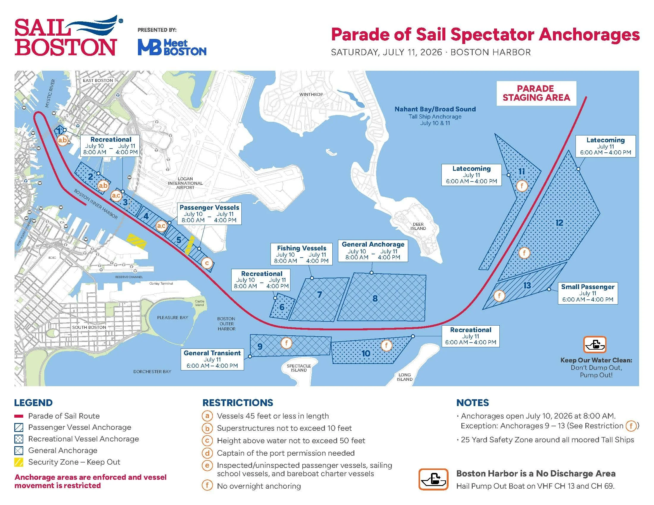
There are 13 designated observation areas called Temporary Spectator Areas (TSAs) in both the inner and outer harbor on 7/11 as well as on 7/10 when the ships arrive off Nahant.
EXPECT THAT THERE WILL BE NO or extremely limited passage through the inner harbor from 8am to 4pm on 7/11.
Once you anchor you are technically stuck there until 4pm on 7/11.
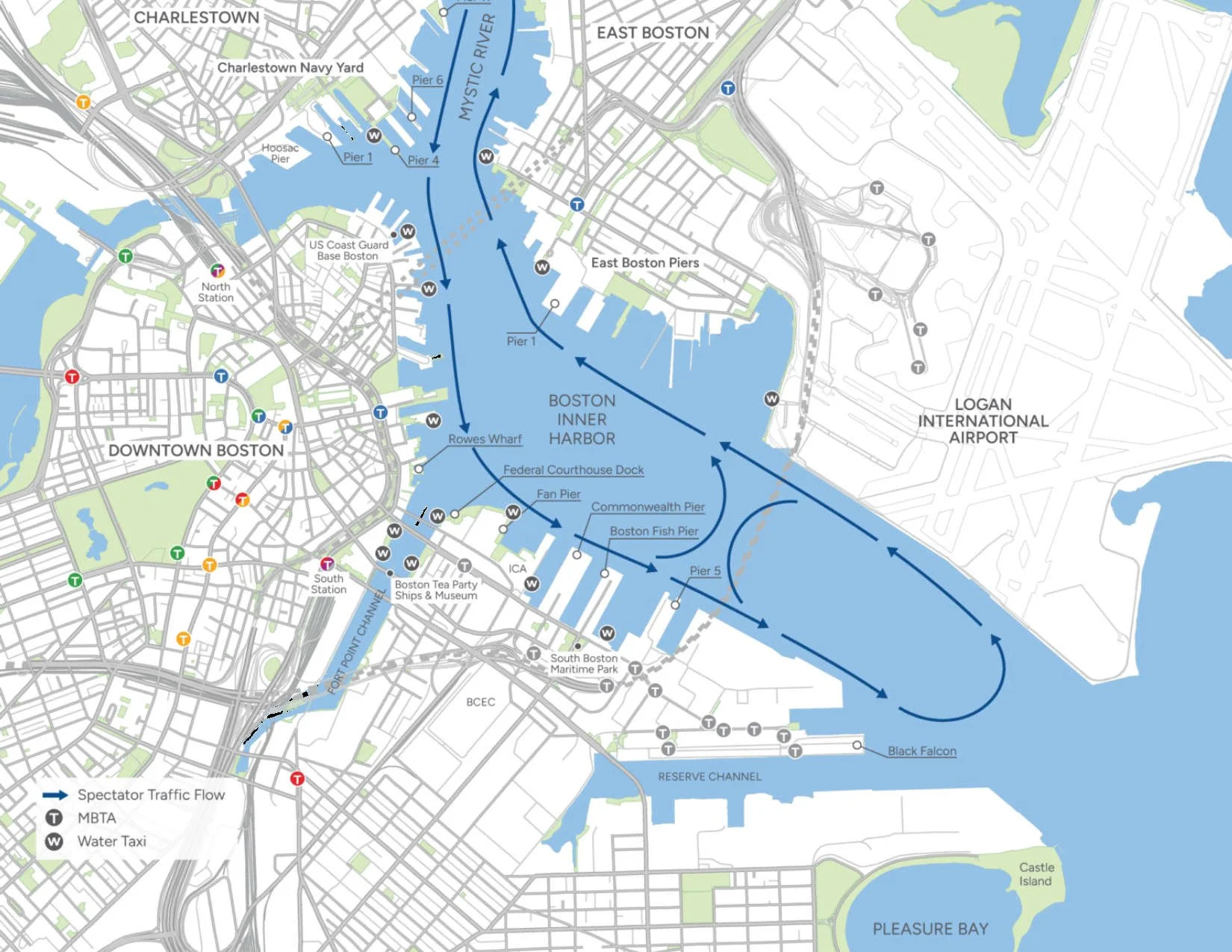
After 4pm you can see all the tall ships by motoring by them via the pre-determined routes shown in the map below.
Fireworks at 8:30pm off Fan Pier
Monday, 7/13
Crew & Cadet Street Parade
Wednesday, 7/15
Fireworks at 8:30 off Fan Pier
Thursday, 7/16
Ships Depart
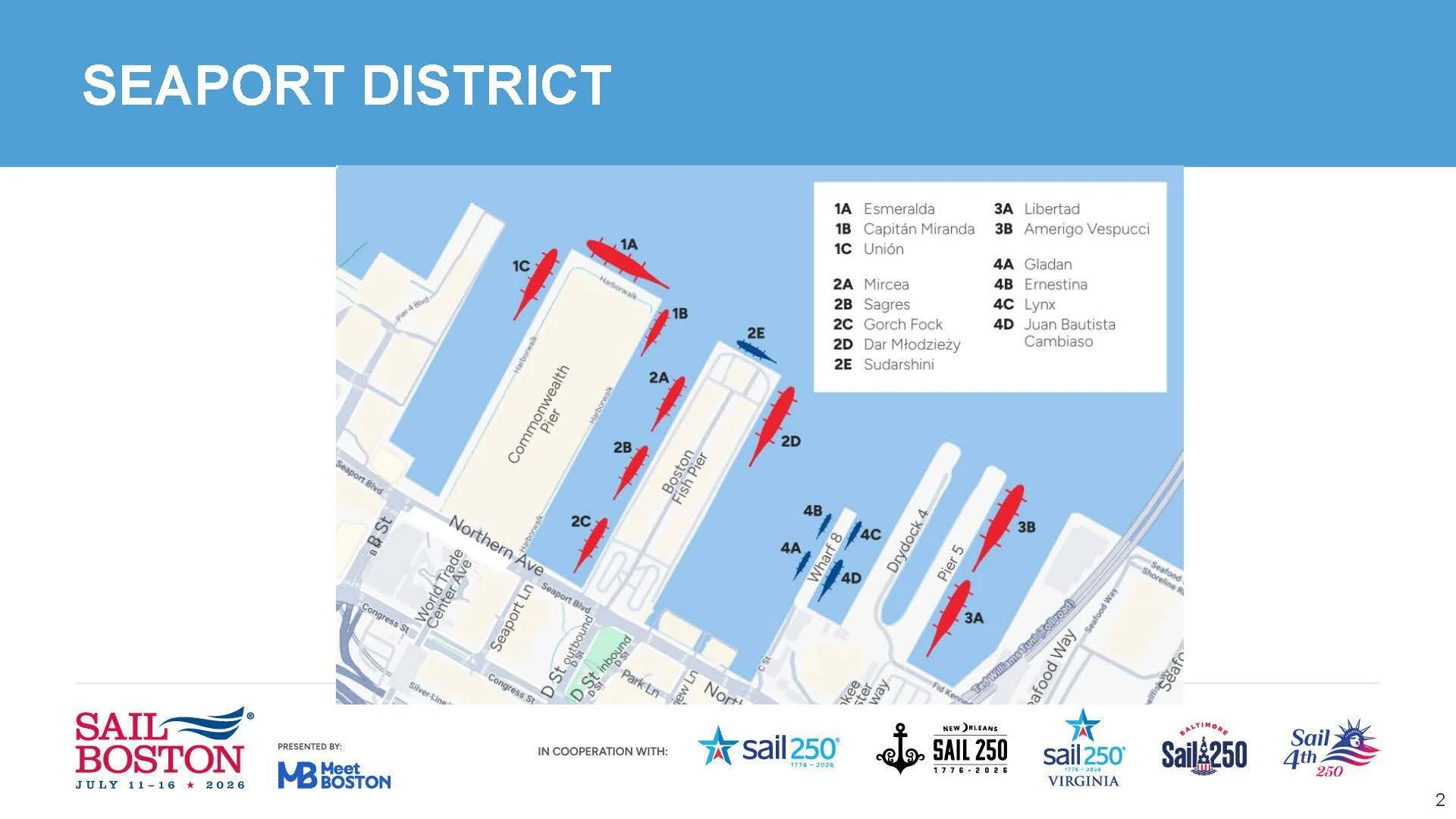
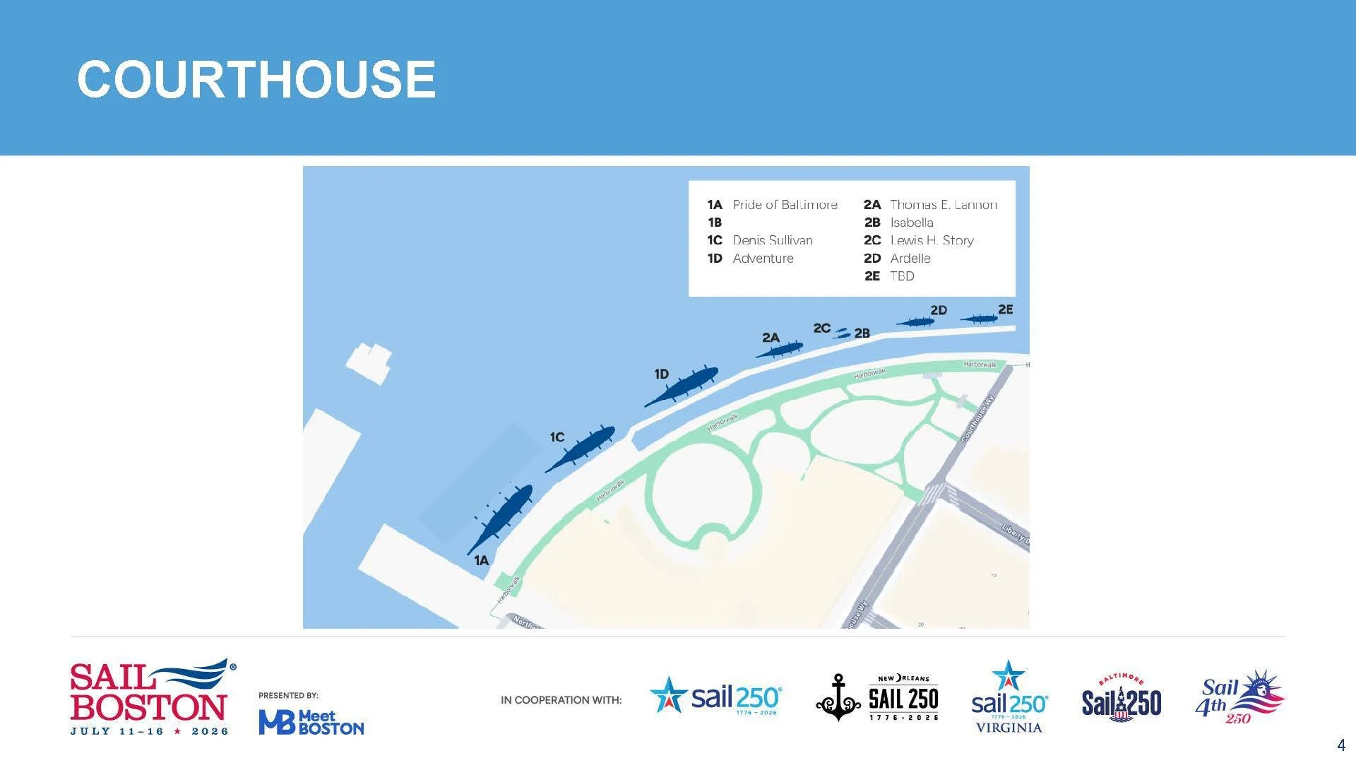
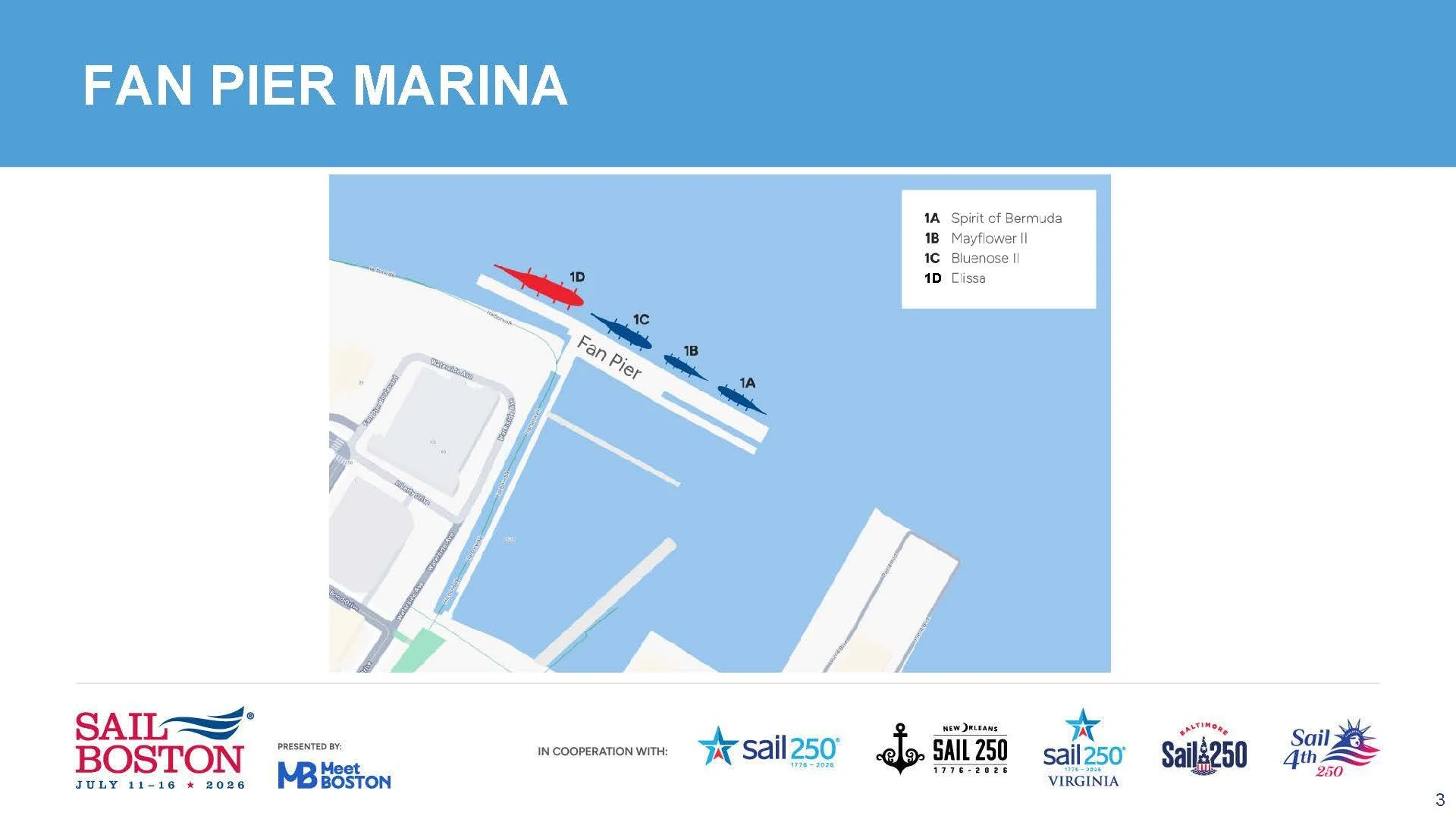
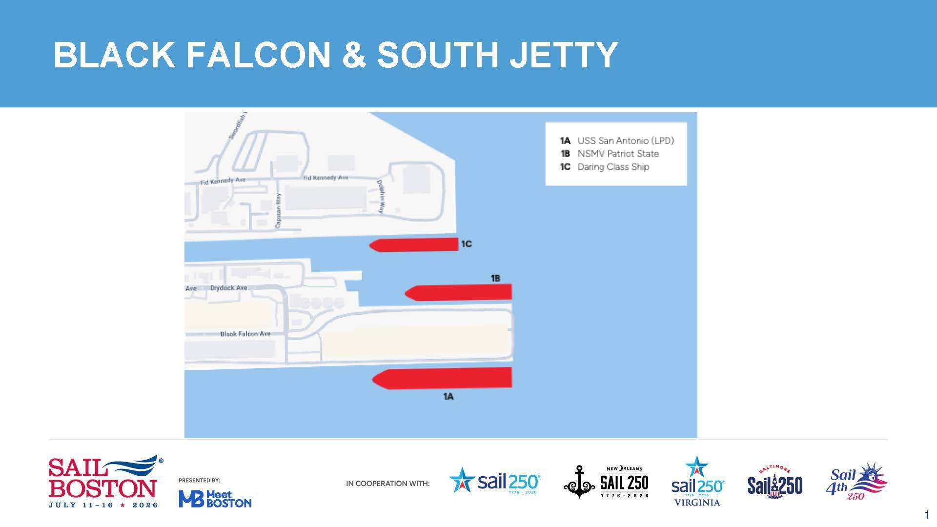
Below, you will find several maps for the Tall Ships 2026. They include:
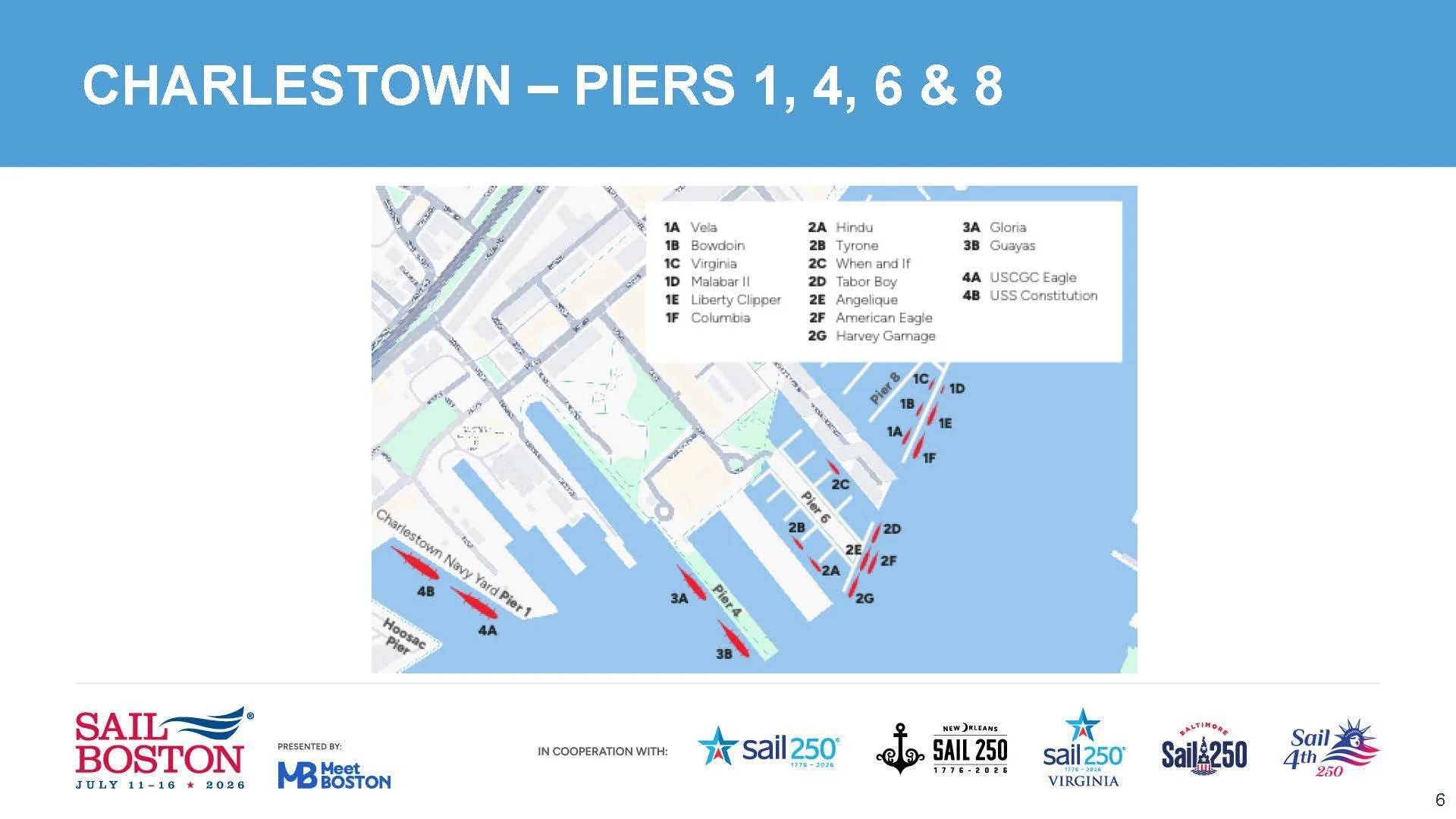
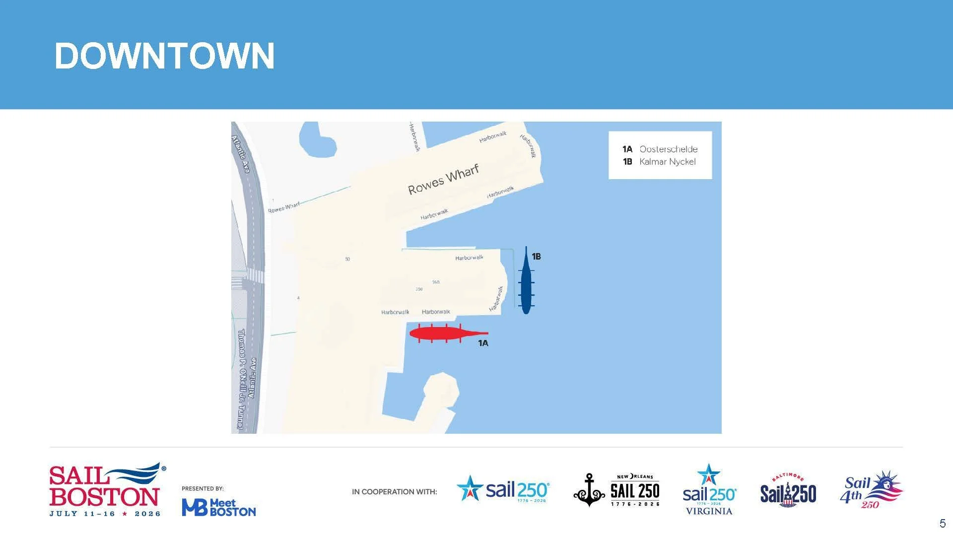
Berthing plan. This shows exactly where each ship will be docked during the event
Anchorage map of where boats can anchor to watch the parade of sail
Remember to NOT anchor outside of these lines. They will ask you to move your boat before the parade begins
Fireworks map, there will be two sets of fireworks, one after the parade of sail on 7/11/26 and another one on the final night the ships are in town on 7/15/26
Spectator vessel movement map showing where boats can travel after the ships arrive and before they leave
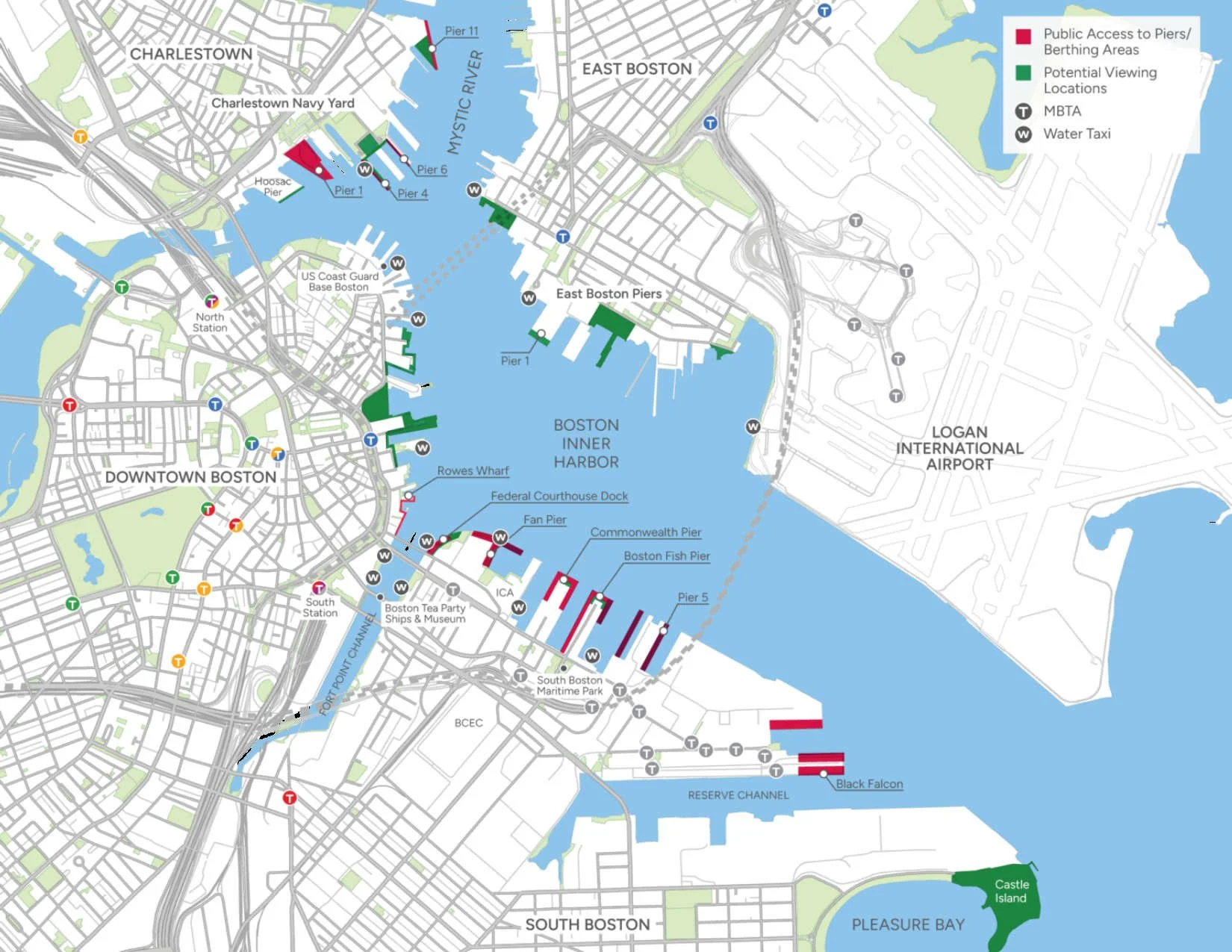
Inner Harbor Map showing where the ships will be located, PLUS the spots where people can watch the parade of sail from shore
To see an interactive map where you can click on each of the points, such as where to see the parade from land, and where the ships will be located, click here https://www.sailboston.com/map/
The Anchorage area shows where the ships will be anchored the day before the parade. This is where you can sail among the tall ships on 7/10/26, and it is outside of Boston Harbor, near Nahant
In addition, to see which ships were invited to attend the Tall Ships event, click here https://www.sailboston.com/ships/ - it shows a picture of each ship. When you click the ship's name, it will show the home port, ship type, etc. Then you can click Learn More to visit their website.